14 Stunning Sights in Death Valley | A Visual Travel Guide
“Death Valley” - sounds intimidating right? My perception of this National Park was based solely on its name. I expected a vast and barren desert, maybe a few animal skeletons and the occasional prickly shrub.
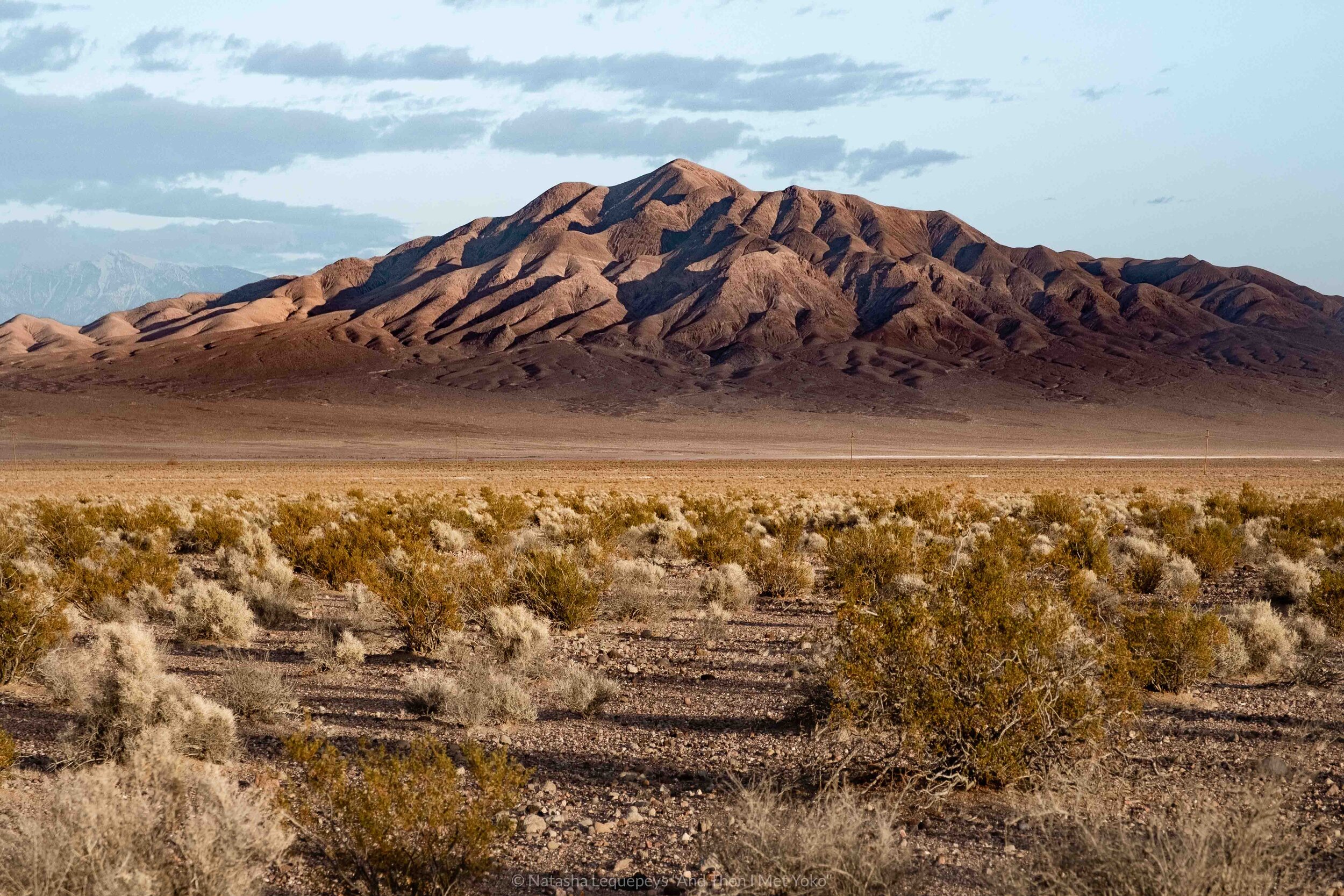
The reality was surprising. The park is an ever changing landscape, highlighting an array of colours and textures. With its incredible rock formations, diverse minerals and changing altitudes, it’s a geologist’s dream.
One certainly feels as if they’ve escaped the city and frankly, the planet.
In this guide I’ll share my road trip itinerary, including those must-see spots and some tips on how to enjoy them safely. With an early start and lots of driving most sights can be visited within a day; however, I’d recommend two days for a more leisurely approach.
GO IF YOU LIKE:
Dunes | Otherworldly Landscapes | Epic Sunsets | Salt Flats | Geology | Stargazing


DEATH VALLEY Itinerary
DAY 1
Morning: Badwater Basin
Late Morning: The Devil’s Golf Course
Afternoon: Artist’s Drive
Lunch: Picnic or The Inn at Death Valley
Sunset: Mesquite Flat Sand Dunes
DAY 2
Morning: Zabriskie Point (consider a hike)
Afternoon: Father Crowley Overlook
OPTION: Drive through Mojave National Preserve to return to LA
Half-day itinerary
Some of us don’t have the luxury of time, here is an option that will take about 4-5 hours to complete.
Devil’s Golf Course - 20 minutes
Badwater Basin - 45 minutes
Artist’s Drive - 45 minutes
Zabriskie Point (leaving through east exit) - 30 minutes
Mesquite Flat Sand Dunes (leaving through west exit) - 45 minutes
Expand the legend in the map for Death Valley attractions
Some links below are an affiliate link, meaning, at no additional cost to you, I will earn a commission if you click through and make a booking. In addition, And Then I Met Yoko is a participant in the Amazon Services LLC Associates Program, an affiliate advertising program designed to provide a means for me to earn fees by linking to Amazon and affiliated sites at no additional cost to you. As always, I only recommend products and services I trust.
Day 1
1. Get Below Sea level at Badwater Basin
Here’s a fun fact - sitting at 282 ft below sea level, Badwater Basin is the lowest point in North America.
This flat stretch of land is one of the park’s greatest attractions and it’s constantly changing. Two weeks earlier there was rainfall which meant large pools of water were still visible, providing a reflective surface of the adjacent mountains. During the drier months of the year it’s more common to see the white hexagonal salt patterns.

“Sitting at 282 ft below sea level, Badwater Basin is the lowest point in North America”
Speaking of salt, it’s the high concentration of salt in this area that has made the water undrinkable - earning the name “Badwater”. In the summer it’s so hot that visitors remain inside their car and view the area from the road. The winter is quite enjoyable and allows visitors to walk out onto the basin. Enjoy the sound of the cracking salt under your feet.
Getting to the basin is quite easy but the car park is small so arriving early is better. For the best photography, visit at sunrise or sunset when the mountains turn rich hues of orange and the sun isn’t too strong. If it rained the prior week, bring waterproof shoes so you can walk onto the pools of water.
Pro Tip: Look for the sign
Look at the cliff across from the parking lot for the “sea level” sign. It gives a perspective on how low the salt flats really are.


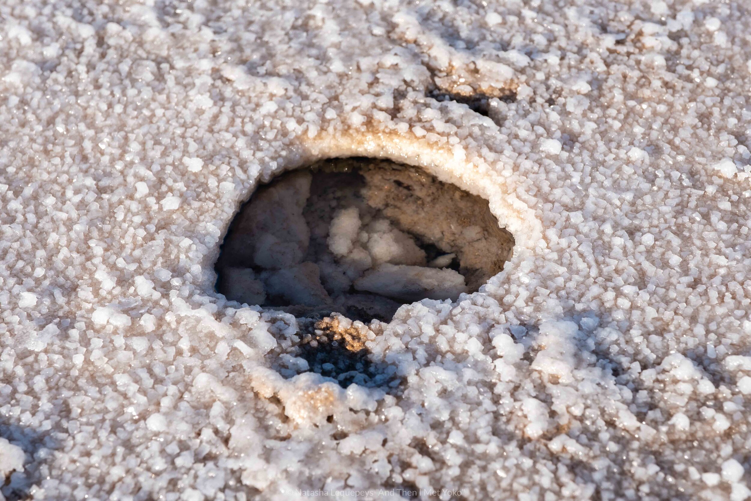
2. Tread carefully on The Devil’s Golf Course
As the name suggests, this is the last place you’d ever want to play golf, only the devil would want to play here. Similar to Badwater Basin, crystalized salt forms the landscape but the difference being that it remains drier so they’re able to grow vertically.
When I first saw the area I thought it would be fragile, that one step would break the salt crystals. But it was anything but that. These mounds are hard and jagged, a fall here would mean cuts and broken bones.
That of course didn’t stop me from venturing out into the area to explore the salt formations in greater detail.

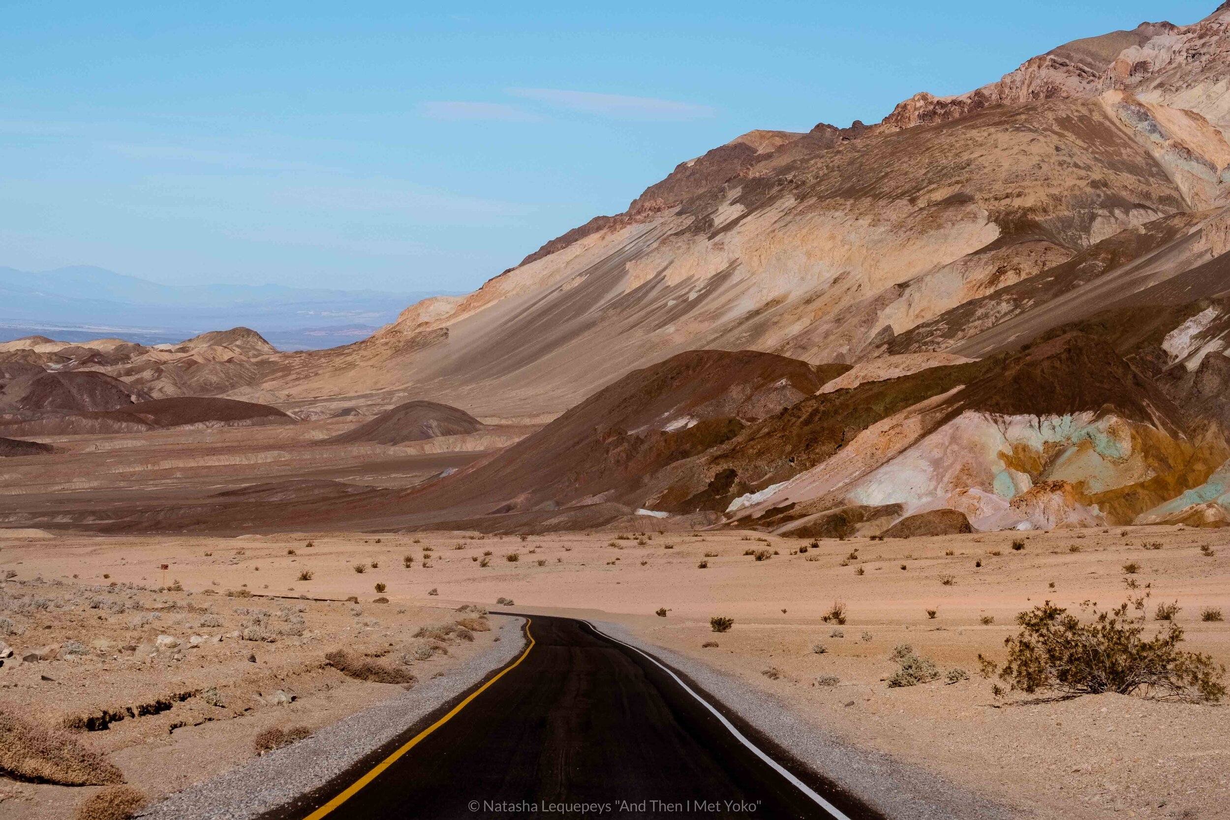
3. GEt inspired on The Artist’s Drive
This 9-mile, one-way road is quite the scenic drive. The surrounding mountains are nature’s original painter’s palette. Volcanic minerals like iron, aluminum, titanium, magnesium and green chlorite have all been found here and provide rich hues of pink, purple, blue, green and orange. These colours are even more apparent after rainfall or when it’s cloudy.
While it’s possible to see the colours from the car, a short walk will provide an up-close vantage point. Be weary of the loose rock, it’s easy to go up but can be scary coming back down.
I particularly loved the canyon at the foot of the hills which I could picture being filled with flowing water during a heavy rainfall.
Photographer Tip: Using a Polarizer
For days with harsh sun, consider a polarizer filter to bring out the natural colours.

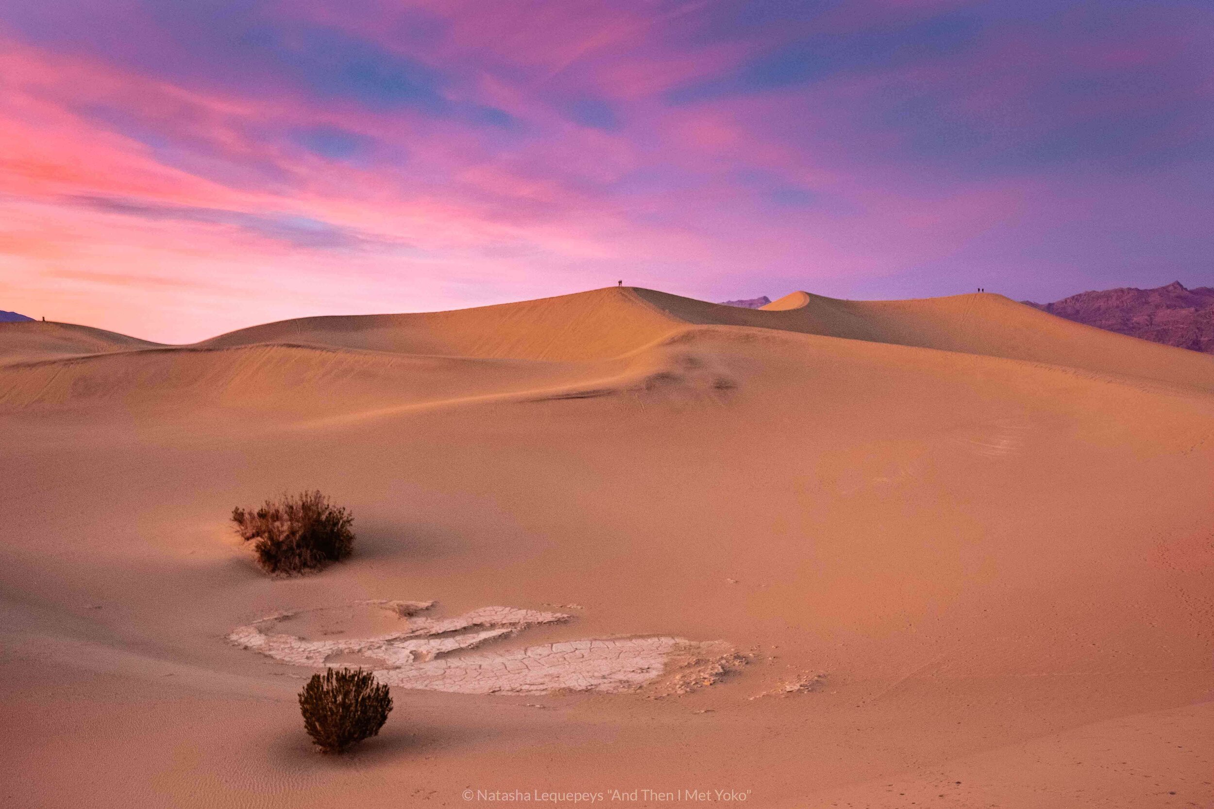
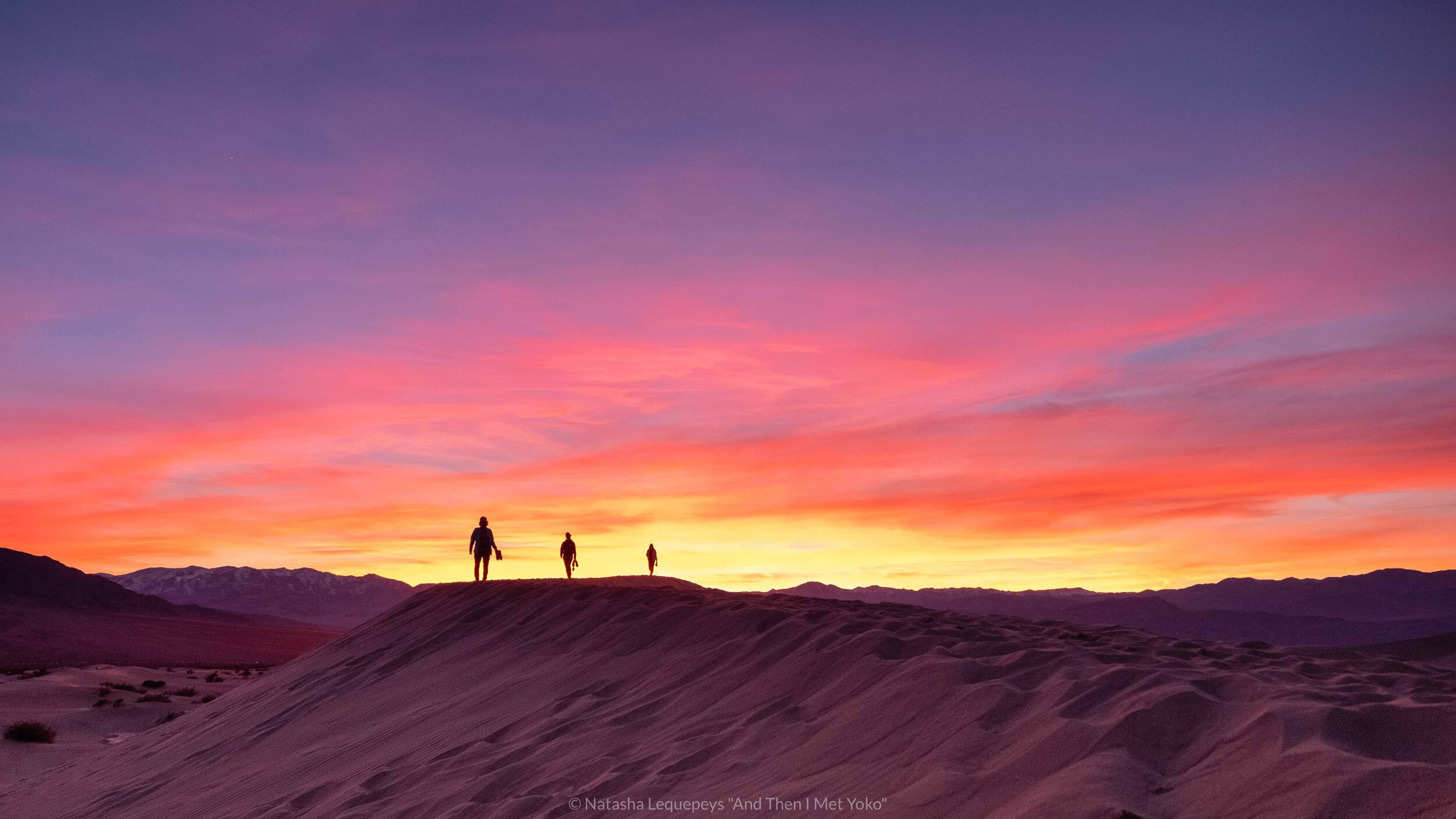
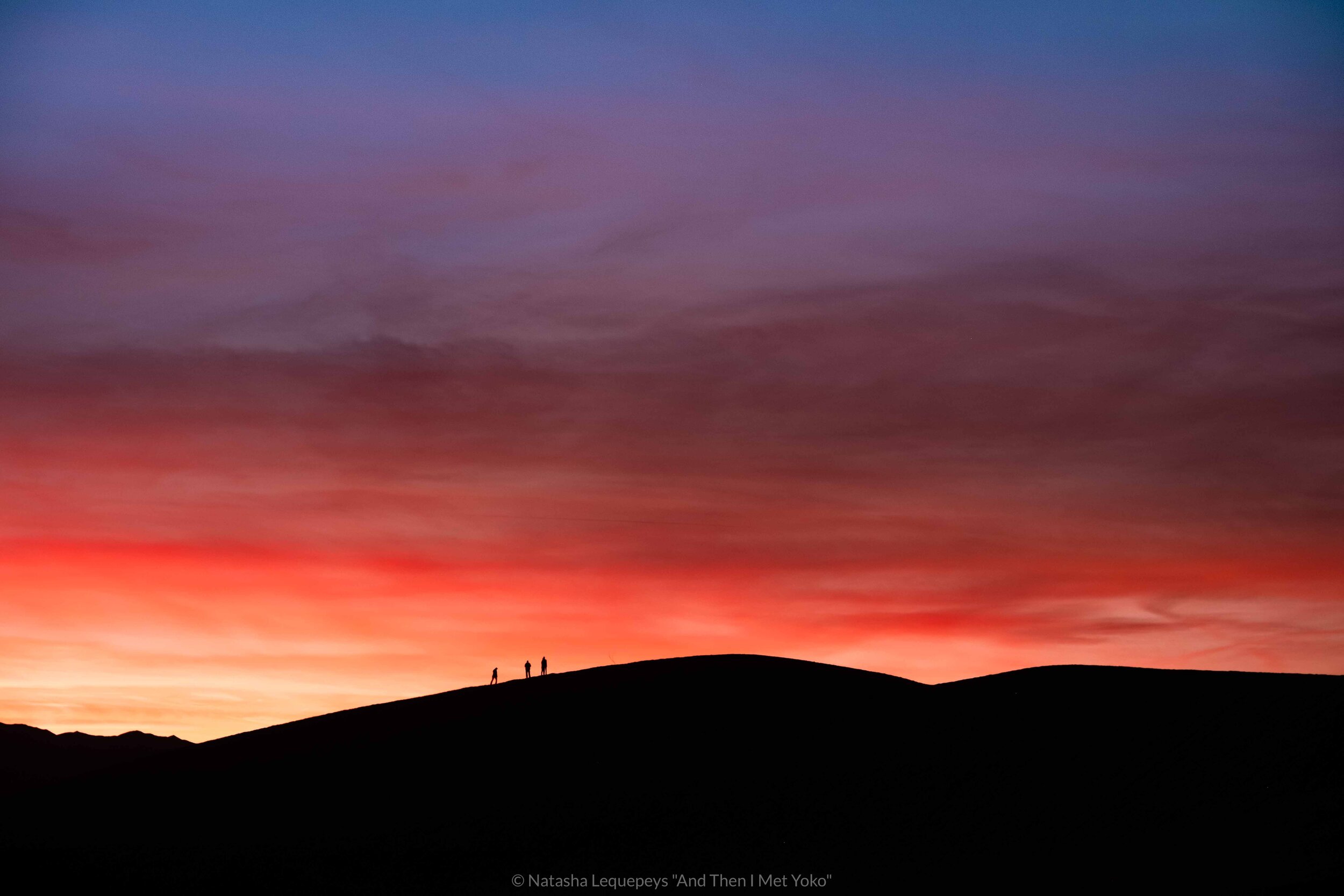
4. Mesquite Flat Sand Dunes
If you’re a photographer, or are just looking to catch a great sunset, then head over to the Mesquite Flat Sand Dunes.
Though sunset is a popular time to visit, I found that putting in the time and effort to walk out to the far dunes will help escape the crowds. If you can, keep going until you reach the furthest dune. I promise, it’s the best view in the whole area as it overlooks both the dunes and the mountains.
When heading back to the car park, reward yourself for the strenuous climb by unleashing your inner child and running down the dunes.
Related Blog Post: Ica, Peru
If you’re a fan of sand dunes then consider adding Ica, Peru to your bucket list.

Pro Tip: Safety from Sidewinder Rattlesnakes
When visiting the Mesquite Flat sand dunes, wear close-toed shoes. While I didn’t see anything, scorpions and Sidewinder Rattlesnakes are hidden under the sand, where it’s cool and safe. They tend to come out at night, but it’s better to be safe than sorry.


DEath Valley Guide Books
You can’t rely on Internet signal in the desert, so consider bringing a guidebook and maps along for your trip.
Day 2

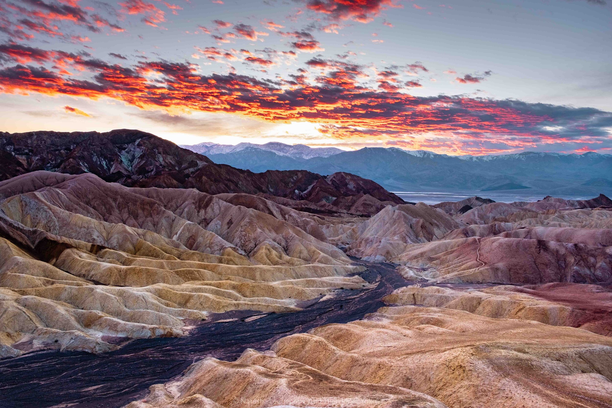
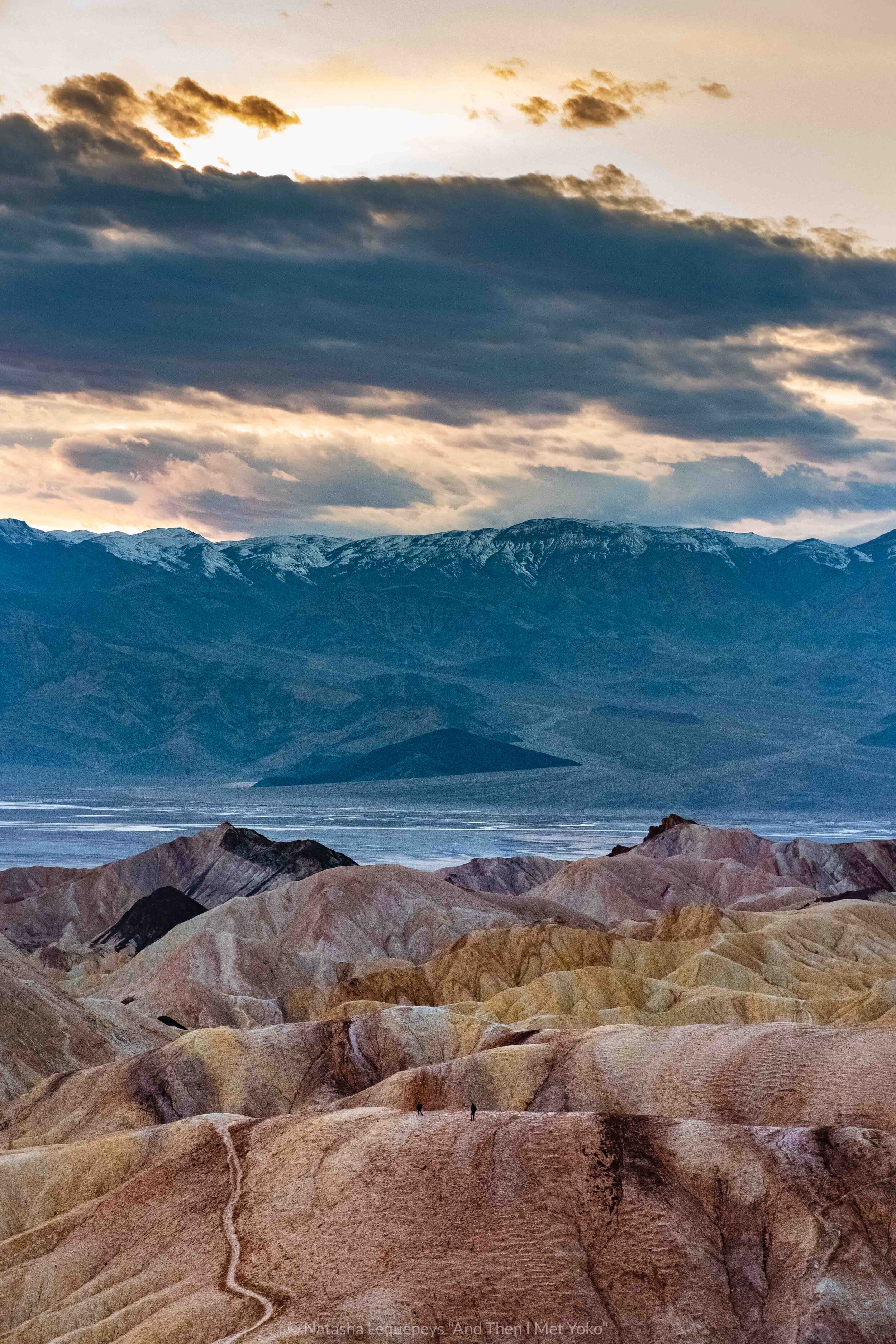
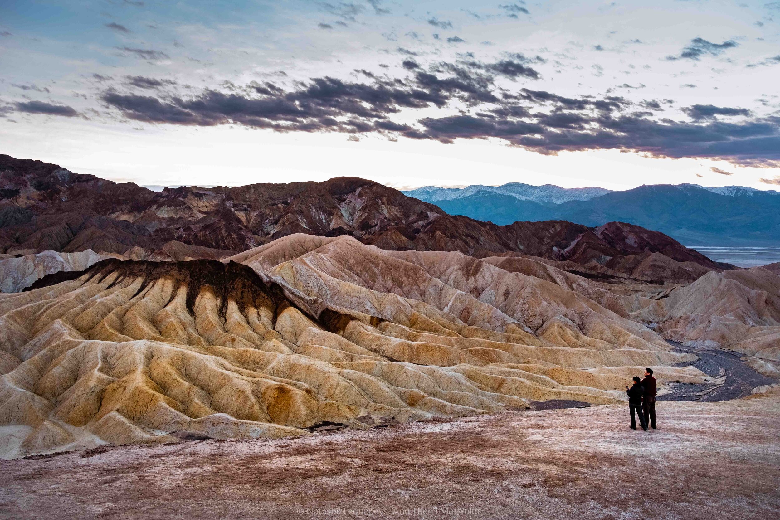
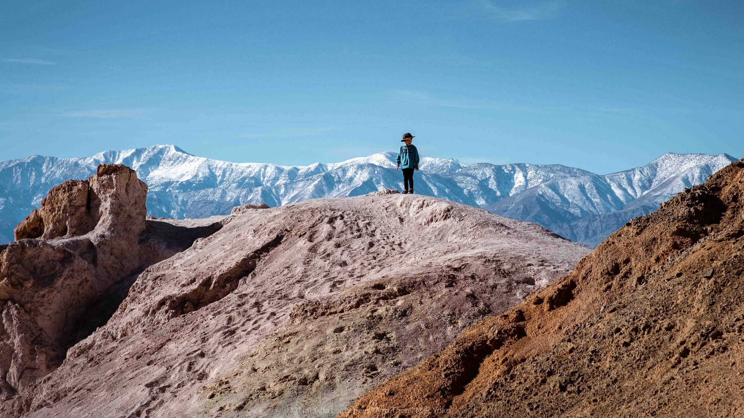
5. Zabriskie Point
This is one of the most popular viewpoints in the park and for good reason. It looks out over the badlands of Furnace Creek which are an incredible array of shapes, colours and textures. It’s really beautiful.
There are a few loop trails and hikes to other vantage points. So, depending on your time and energy level, venture out and appreciate the view from different angles.
I showed up just as the sun was setting, there’s no denying the colours were unbelievable.
Pro Tip: Go for a Hike
Unlucky for me, I arrived just as the sun had set but if you come early, or start your day here, then there is a popular hike that starts from Zabriskie Point. Only tackle it if visiting in the cooler months and early morning. Here is a map of the trail.


Related Travel Guide
If you enjoy exploring nature and are a sucker for those west-coast sunsets then check out my travel guide to Northern California and the coastal redwoods.


6. Spot some military jets at father Crowley Point Overlook
This area is located at the west entrance of the park. Getting there from the main sights on the east takes about an hour and a half but there are a few reasons it’s worthwhile.
Firstly, with winding roads that ascend in elevation to over 3000ft, the landscape is constantly changing. I passed flat open land followed by snowy mountain ranges. This in itself made for a beautiful drive.
Secondly, this is a popular spot to see active military jets, performing low-level flying drills. The car park overlooks Rainbow Canyon, also famously known as Star Wars canyon. With layers of black and red volcanic rock, this 5-mile-long canyon is where you may catch a glimpse of a military jet zooming by at over 500 mph. The canyon and jets, conjure up visions of young Anakin and his pod racing.
Don’t forget to walk out on the dirt path to witness an even more impressive view of the surrounding valley and winding roads.
Pro Tip: Spotting Military Jets
If you’re lucky, you may spot military jets in Eureka Valley or Saline but Panamint (Rainbow Canyon) is where most aviation buffs will be on the lookout.
Make sure to keep your eyes open and ears focused on any distant rumblings. If a jet passes through the canyon it will be gone with the blink of an eye. Though there are no schedules, it is said that you’re less likely to see jets on Mondays and weekends. I didn’t see any but that doesn’t mean it’s impossible.

About The name “Death Valley”
So now you’ve gotten a glimpse of the park and you may be wondering about the name. Well the valley had to earn the name somehow, here’s the story behind it.
The story of the Lost 49ers
Way back in 1849, amidst the hype of the gold rush, a group of pioneers headed out West in search of Californian gold. Over 200 people in their caravans left Salt Lake City and headed South, through Utah, to California.
On their journey they heard talk of a “short cut” so several groups changed their route in hopes of reaching California sooner. Upon arriving in the valley, they were confronted with extreme heat, no water or food and terrain which was unpassable with wagons.
They eventually split up and started walking, this included the women and children. One of the groups tried to head South, in hopes of finding a lower pass over the Paramint Mountains but they ended up getting stranded. They sent two men over the mountains to get help. The help took over a month, not days as was planned, and one man from the group died. When help finally returned and they all moved on it was said that one man looked back at the desolate area and said, “ goodbye Death Valley”. The name stuck.
Knowing the story of the lost 49ers makes a visit to Death Valley even more thrilling as one can appreciate the anxiety that these early pioneers would have felt when confronting this landscape.
So when you visit Death Valley imagine the following:
You have no car, no water, no food. You’re seeing slat flats in the distance thinking that it’s an oasis only to arrive at dry land. You finally reach Badwater Basin, and see water but it’s salty and undrinkable. Then you stumble upon Devil’s Golf Course, knowing that wagons cannot traverse this land, you’re forced to divert. And all of this is happening as you approach the looming Paramint mountains, which will inevitably need to be conquered.
Think about all this, then get back in your air-conditioned car and thank your luck.
Handy Things to Bring to Death Valley
Don’t forget these essentials on your trip.
For Next Time
7. Natural Bridge
A 45-minute hike that takes you to a natural arch formation, created by the erosion from water.8. Ubehebe Crater
A 600ft volcanic crater. Need I say more?9. Wildrose Charcoal Kilns
Completed in 1877, these 10 kilns provided fuel to nearby mines. An interesting spot to learn some history and see a man-made creation.10. The Racetrack
A dry lake bed that has rocks with large trails behind them. Naturally occuring over years of wind erosion, these trails make it look like the rocks are moving.
*Note: This area can only be accessed with a proper 4x4 for offroading. Normal rental cars won't be covered and there can be clearance issues and high probability of flat tires. In addition, there is no cell phone signal so be prepared with proper maps and supplies if you plan to visit this area. Also, do no touch or move any of the rocks (yes, it happens).
11. Stargazing
Death Valley is a great place for stargazing. Areas like Badwater Basin are perfect for parking your car and checking out the night sky.12. Dante's View
A viewpoint from high up the Black Mountains.13. Golden Canyon hike
There are several trails depending on how strenuous of a hike you're looking for and how much time you have. They will take you through the Badlands with close-up canyon views.

14. Drive through the Mojave Desert
If Los Angeles is on your itinerary then I recommend driving through a part of the Mojave Natural Preserve. Especially if you are not able to visit Joshua Tree National Park but would like to see something similar.
We drove on Kelbaker Road which starts at Baker, passing Kelso to meet the 40 in the South. It was such a beautiful drive, and there was practically no one on the road.
Like Death Valley, this area was ever-changing. It started out flat, with distant mountains. Then a few Joshua trees crept into the landscape, eventually covering the ground. They faded away as quickly as they came, to reveal Granite pass, an area covered by large boulders.
Drive carefully and keep your eyes open because the area is known to have tortoises and other little critters.


Death Valley Accommodation
Unfortunately I don’t have any exciting accommodation recommendations for Death Valley. The park itself is home to a few budget resorts and one “luxury” property, The Oasis at Death Valley. While I didn’t stay at The Oasis, I went for coffee and cake and let’s just say that the service and facilities didn’t look like it was worth the hefty price tag. If you have the budget, it’s the nicest option but I wouldn’t call it luxury. You’re paying for the convenience of the location.
I opted to stay in the nearby city of Pahrump, Nevada. To this day I still don’t know how to pronounce it. While, it’s not much to rave about, the accommodation is cheaper and so is the gas, making it a perfect place to fill up before heading into the park. You can find all the big American fast-food chains and some BBQ restaurants. I tried to eat at the one Thai place that had good reviews but it was closed on both nights so I can’t even recommend that.
Pahrump, Nevada
Affordable hotels, a 35-minute drive to Death Valley Junction (park entrance).
Hotel Holiday Inn Express and Suites Pahrump - My Recommendation, good breakfast
Best Western Pahrump Oasis
Inside Death Valley National Park
I belive that the price for this accomodation is way too much for what it is, but if you're looking for convenience then it is a good option.
The Inn at Death Valley
The Ranch At Death Valley
Las Vegas
Being a 1 hour and 45 minute drive from Death Valley Junction, I wouldn't recommend staying in Las Vegas unless it was part of your itinerary and you weren't planning on going back to Death Valley.
There are so many accommodation options here, it really depends on your style. Here are a few top-rated places.
Bellagio
The Venetian® Resort Las Vegas
ARIA Resort and Casino
Where to Eat in Death Valley
Tricky answer because I could say both nowhere and everywhere.
By nowhere, I mean there are no real restaurants inside the park. You can eat at “The Inn at Death Valley”, which will be expensive but likely the best food. I had dessert and coffee there. It was OK.
There are apparently a few restaurants by Stovepipe Wells village and Panamint Springs. I cannot tell you if they’re good or not but I’m thinking it’s the latter.
My recommendation is to stock up for lunch at a grocery store and picnic anywhere in the park that inspires you. My husband and I were driving and suddenly felt hungry. We pulled over to an area with a great view and ate by our car. In the winter, food can last in the car, but if you’re visiting during the warmer months, I suggest bringing some ice packs and an insulated lunch box.
Please remember to take ALL garbage and food with you from the park. #LeaveNoTrace

Transportation in Death Valley
Car Rentals
You will need a car to visit Death Valley. You can easily rent a car in California or Nevada. We picked ours up at LAX since we needed it for LA anyways. Know that renting a car in California legally requires third-party liability insurance. Bring your car insurance policy with you and if you don’t have one, expect to pay extra for that insurance as it’s a state law.
Also note, some low-budget car rental places have specific requirements on which states they cover for service. Make sure that your car rental covers both California and Nevada, you don’t want to have a breakdown and not be able to get help.
Make sure you are driving with a spare tire, as the roads are bumpy. Also note that most car rentals do not cover backcountry driving, so you’ll be required to stay on the roads. All the main sites can be accessed by roads and basic car rentals are fine. Off-road driving is prohibited throughout the park.
Gas
Nevada seemed to have cheaper gas than California. So filling up there will save you some money.
Tours from Las VEgas
Since I haven’t taken a tour, I can’t recommend one, however this is a top-rated tour from Las Vegas on Viator.
Best Time to visit Death Valley
Choosing the right season to visit Death Valley can make or break your experience. With such a variance in temperature, it’s important to understand the limitations that each season may bring.

Spring
The spring is a great time to visit Death Valley. The main reason is that if there was good rainfall from the winter, the warmer weather means wildflowers may bloom. This tends to occur in late March/early April. This is a very popular time to visit, so make any accommodation bookings as early as possible.
Check the wildflower and superbloom status here
Summer
Visiting Death Valley in summer would be my definition of hell. Starting in May it’s incredibly hot, most people don’t leave their car. This is especially heightened in the low-elevation areas like Badwater Basin. Rumour has it, birds have fallen out of the sky. No thanks.
Autumn
With cooler days than the summer and less crowds than the spring this would be a nice time to visit Death Valley. November is particularly busy due to a western heritage festival and Thanksgiving.
Winter
Though the days are shorter, this is a wonderful time to visit Death Valley (I visited the first week of January). Expect cool days with cold nights. By mid-day I was out in a t-shirt. Layering during winter is smart. For photographers this is when you’re likely to see some snow on the mountain caps, and with higher chances of rain you may get pools of water by the Badwater Basin. Christmas is quite busy but the time between Thanksgiving and Christmas has the least amount of visitors throughout the year.
Death Valley - Park Safety and Tips
Cell phone reception
There is limited cell phone reception within the park, so don’t rely on that to get around. Download offline maps through Google Maps or visit the Furnace Creek visitor center to find out more about the park. Consider getting a guidebook/map.
Dehydration
Make sure you’ve got extra water in your car, especially if you’re visiting during the summer. You don’t want to have a car malfunction and be without water in Death Valley. If you’re visiting in the hotter months, aim to drink between 2-4 liters of water per day.
Gasoline
There aren’t many gas stations inside the park. It’s best to make sure your tank is full before entering the park. We found filling up in Nevada much cheaper than California. Try to maintain at least a half tank of gas whilst in the park.
Flash Floods
If there are heavy rainfalls, flash flooding may occur. Stay out of the canyons if there are chances of thunderstorms.
#LeaveNoTrace
Do no collect, remove or disturb any of the natural surroundings. Take all garbage and food waste with you from the park.
Toilet Facilities
At each of the major sites are toilet facilities. They won’t be pretty and are often smelly but they will do the job. Most of them don’t have lights so you’ll want to bring light into the stall with you after sunset. Also note, these facilities don’t have sinks to wash your hands so don’t forget your hand sanitizer.
Entrance Fees and tickets
Unlike other National Parks, Death Valley doesn’t have entrance barriers, so purchasing a vehicle ticket is something you have to initiate on your own.
Once you enter the park there will be signs for payment stations where you can stop, input your vehicle information and then put the printed ticket on your dashboard. While I didn’t see anyone checking tickets, I firmly believe that $30 for a vehicle for 7-day access to the park is a steal. Pay up - the national parks need your support.
Find out about all the fees and ticket purchasing locations here.
Backcountry Driving
I’m no expert on this but Death Valley has some backcountry roads though the park doesn’t permit off-roading. You’ll want to make sure you have a proper map, gear, and lots of water if you go about doing this. Check out the road conditions too, as you wouldn’t want to get stuck out there. Learn more on backcountry driving.
Read Other USA Travel Guides


Explore the desert of Ica and the oasis at Huacachina. I share my tour recommendation and tips on where to stay and what to see and eat.